VA04644-04685-3x1v 10000x6100 pixels 3 column 1 row 3 frame 42 shot focus stack stitch blend a6700 30mm
enlarged vertical slice view image text section
NEXT: Page 7 Calaveras Big Trees State Park
2025 Trip Chronicles: Contents
Eastern Sierra 10/13
Eastern Sierra 10/14
Eastern Sierra 10/15
Eastern Sierra 10/16
As the first week of October closed, weather forecasts were predicting a mid-October cold front to bring snow across the full Sierra Nevada with snows down below 7,000 feet. My last fall leaf work in the Eastern Sierra had been several years before, in 2020. Given a large body of previous fall leaf work over decades, I won't bother to make the long 250+ mile drive unless weather conditions are favorable; that means uncommon periods of diffuse cloud light and light breezes. And any October storm cold enough to leave snow on fall leaves is of particular interest. Most of my earlier work was large format film view camera work that has not yet been expensively drum scanned, thus is not readily available for my website use. With my new Sony a6700 camera with its focus bracket function, this was a chance for me to capture some high-quality fall leaf digital images.
Today, unlike years ago, there are a few excellent fall leaf condition websites on the Internet. They indirectly showed peak color had moved down to lower elevations of 6k to 8k. That is where the best riparian color exists, with larger trees and other tree and shrub species adding a mix of colors. Mid and upper leaf color locations that are mostly aspen were reporting being well past peak.
Over the sunny weekend, I attended both days of a street art/food/music fair in San Carlos, 30 miles to the north, enjoying rock cover and tribute bands as I have extensively done over the past few months. Thus, upon waking about sunrise on Monday October 13, 2025, I was not too lively and had done zero gear preparation except for a good stock of adequate food and drinks. The forecast storm was not supposed to become serious until midday Monday and would start out with higher snow levels. So my lack of preparation was in part due to knowing I could get organized early Monday morning, then get on the road by mid-morning, and still cross Sonora Pass. All Sierra Nevada highway passes were still open Sunday evening, but some would likely close during the storm. By 10:30am PDT, gear was in my June-purchased, used 2023 Trailblazer LS with 22k miles, so I was on my way east without traffic issues, as slow commute traffic is in the opposite direction from the valley.
My driving plan was to go across 9.6k Sonora Pass on SR108. But by the time I reached Jamestown about 12pm, a highway sign showed SR108 had closed, and SR120 through Yosemite (Tioga Pass 9.9k) was scheduled to close at 1:30pm, which I didn't have confidence I could reliably get across before. So, parking roadside, I used my smartphone to find that SR4 (Ebbetts Pass 8.7k) and SR89 (Monitor Pass 8.3k) had also closed earlier that morning by CALTRANS. I thus vectored out on Rawhide Road to SR49, then north to Jackson, an extra 42 miles and an hour-plus, where I then went east on SR88. Note, I often drive SR88 during ski season to Kirkwood. By the time I reached Hamm's Station at 5.4k elevation, temperatures had dropped to 38F with sleet falling. At 7k, it was 31F with snow, so I had about 35 miles to drive in falling snow. The highway was, however, just wet without chain controls because of warm ground/pavement temperatures.
I was quite pleased with the Trailblazer's excellent windshield wiper ability to clear snow for visibility. And after the storm, I am much more confident about the vehicle dealing with snow for this coming 2025/2026 winter, my first time using it in at least some snow conditions. Very capable of dealing with unpleasant road surface conditions. And that included playing around, driving in a few inches of accumulated fresh wet snow. But very different stability/balance wise than my old Forester, as the driver's seat is up way, way higher, which gives it a very different feeling when moving. Note, I also Amazon-purchased and own some $62 225/65R17 chain link tire chains, per CalTrans R2 requirements.
On SR88 east of Carson Pass, given a minor, limiting storm visibility, I looked carefully at the passing, very familiar Hope Valley, quaking aspen groves, and in the admittedly dim light, they looked rather uninteresting. Lower, below the SR89 junction, most were also past peak; plus, cold air canyon damming had caused some blackening leaf damage. But as expected, below where the river enters the narrow canyon, blocking the cold air pooling in the valley above, the trees of all species looked excitingly to me worth at least a day and night's visit. Just as I've been thinking about for years since it has much red-hued creek dogwood easily visible from driving by, but I just never made time for.
About 1pm, I reached the US395 at the south end of Gardnerville, Nevada, where the cheap $3.67 per gallon gas fill was welcome. Along the way south on US395, in at most light sleeting conditions but with good highway driving illumination, I had a chance to look at aspen groves about Conway Summit, the 8320+ Virginia Creek Road crossing, and Lundy Canyon to the west end of Lundy Lake Reservoir, which I was relieved to see looked optimal. Later that evening, lying in the back bed of the Trailblazer, that made me more determined to optimistically make the most of this east side road trip, as strong fall leaf subjects were available.
By 4pm I had reached Lee Vining at 6.9k, with the temperature a wet snow 34F, where I also drove a bit west on SR120 to see what trees there looked like.
I went into the Mobile Mart for a $5 pepperoni pizza slice and then drove to a discreet remote site along nearby Utility Road to park overnight, where I spent a couple of hours reading a neuroscience book. My Trailblazer back bed is comfortably set up for sleeping, with gear organized much like I had with the Forester. At 2am, I awoke to a moderate-level snowstorm, with the temperature now 33F with slush a couple of inches deep on the road. Afraid there was a small chance the storm might become worse than predicted, I drove down to Lee Vining and parked at Gus Hess Community Park along Mattly Avenue for the rest of the night.
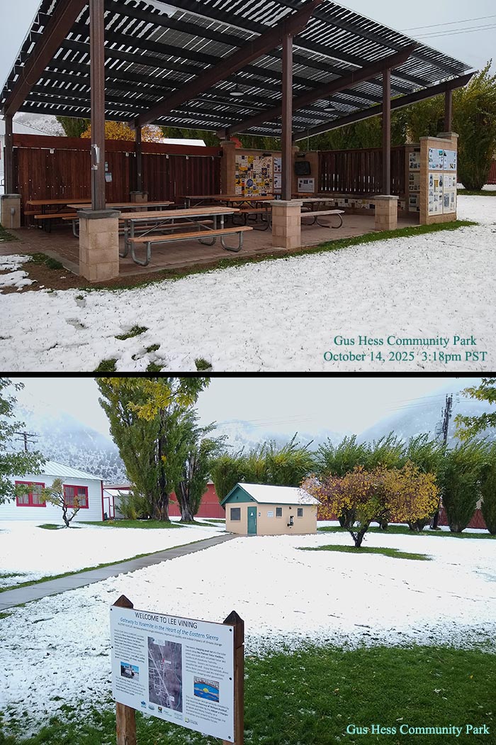
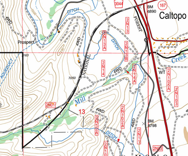
As forecast, the storm continued nonstop at least at a low level all night, and when I woke about sunrise Tuesday, October 14, 2025, about 4 wet, slushy inches of new snow covered my car. At most, I could work photographic subjects in sprinkles with low breezes, so I stayed comfortably in the car till mid-morning. What I really needed to do was buy a hands-free umbrella system with a back harness and, in fact, after the trip, I did so. That way, I'll at least be able to work subjects while precipitation is falling more lightly in less breezy conditions. I took another drive up Lundy Canyon as far as the west end of the lake. Beyond the east canyon opening, trees looked uninteresting past peak due to cold air pooling behind the canyon narrows. But the trees along Mill Creek east of that, below 7k, were at peak. A zone I'd extensively explored in the past. The Mono Lake water level is currently at about 6380 feet, or 300 feet below the town. At this time of year, the best dawn or dusk light with foreground pumice rock islands will be from the northwest end of the lake along US395 just north of the private road "boat dock" that requires some awkward walking across a now wildfire scrub vegetation burn zone to reach the shore edge. Since the big winter of 2017, the lake has risen to cover what was far more surface pumice islands.
It snowed at least lightly all day as I drove about aspen areas looking at conditions through my car windows. I did not want to get my rain clothing unnecessarily wet; that, inside a vehicle, just evaporates and then clouds up interior windows. About 1:30pm, I drove south to June Lake Loop Road, CA158. At Grant Lake at 7131 feet, the landscape was mostly white, with snow barely covering the irregular sagebrush terrain. I continued all the way to Silver Lake at 7215, with its large campground showing many vehicles. Numbers of photographers with tripods were moving about usual aspen areas that, to this person, looked well past peak, with many leaves dull and browning. That was predictable because, despite modest elevations, Reversed Creek Canyon dammed cold air behind the canyon narrows of Reversed Peak.
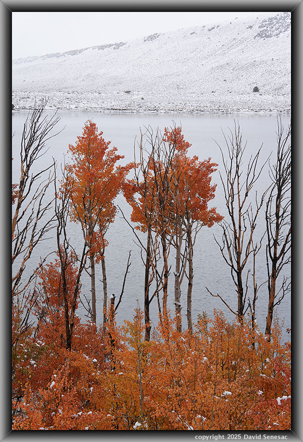
VA04064-75 4100x6150 pixels 1 frame 12 shot focus stack blend a6700 56mm
enlarged vertical slice view
Seeing those conditions, I drove back east to a Grant Lake location where orange leaf aspen trees could be shot with the lake behind for nice isolation. Adjacent bare tree branches provided contrasting dark elements, enhancing a sense of sharpness. The distant shore, with its salt-and-pepper appearance and storm and snow whiteness reflecting off the small lake wave surface, well captured the subdued storm atmospheric conditions that these vibrant aspen leaves were still able to prominently stand out within. Sunlight passing inside the transparent leaves reflects off non-absorbed chemical leaf pigments, increasing summed brilliance beyond what a surface reflection of, say, a same colored rock would otherwise offer.
After parking there, about half an hour in light misting sleet, a lull occurred, allowing me to work the above subject; that would be the only time I got my camera out all Tuesday. After the trip, I purchased hands-free, body-harnessed, self-supporting umbrella gear that will allow more active photography work in at least light rain or snow. I already have a large 3 mil plastic covering bag for rain protection while traveling with my camera tripod mounted.
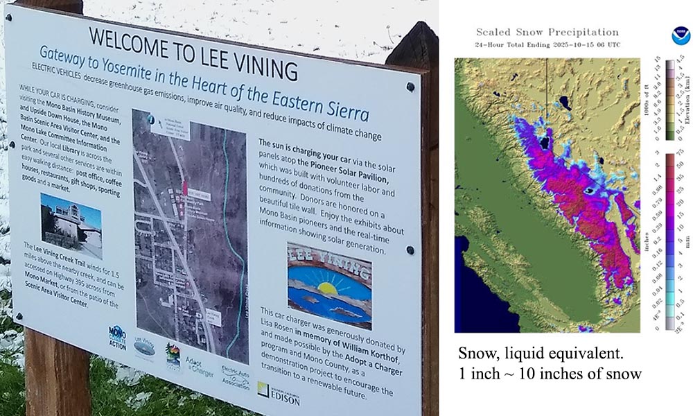
Back in Lee Vining, I regretfully bought a rare for this non-red-meat person, hamburger that had me feeling bloated for hours. Again, spent the night at Gus Hess Community Park, where I could have easily cooked canned soup outside under an outdoor solar shelter with benches. The recently upgraded park has the cleanest rural outdoor restrooms I've experienced in years. It also has a nice kids' playground, drinking water, views of Mono Lake, and one EV charging station. By sunset, the temperature was down to 31F with heavier snow squalls leaving snow across the landscape.
I've been sleeping inside my vehicles during road trips for decades with rear seats that fold down. Inside my Trailblazer LS back bed is a quality foam exercise mat, my backpacking Z-Rest pad, and an old synthetic sleeping bag, with my expensive 800 goose down fill 15F Nemo Aya sleeping bag I usually just use on top, unzipped. Although sleeping in vehicles with an engine off and windows fully up is supposedly not dangerous, I always keep a couple of windows slightly cracked open for fresher air. That can allow water in during rain/snow, and during summer at night with lights on inside, say reading, can attract night flies, moths, and mosquitoes. I have a new plan to design a remedy by using GoPro helmet mounts to support an attached small, flexible, removable rain cover above the rear passenger-side door top. For summer, that will hold a width of mosquito netting. Most of my gear is organized with bags, boxes, and packs, so it is easy to switch around from day use to night sleeping use.
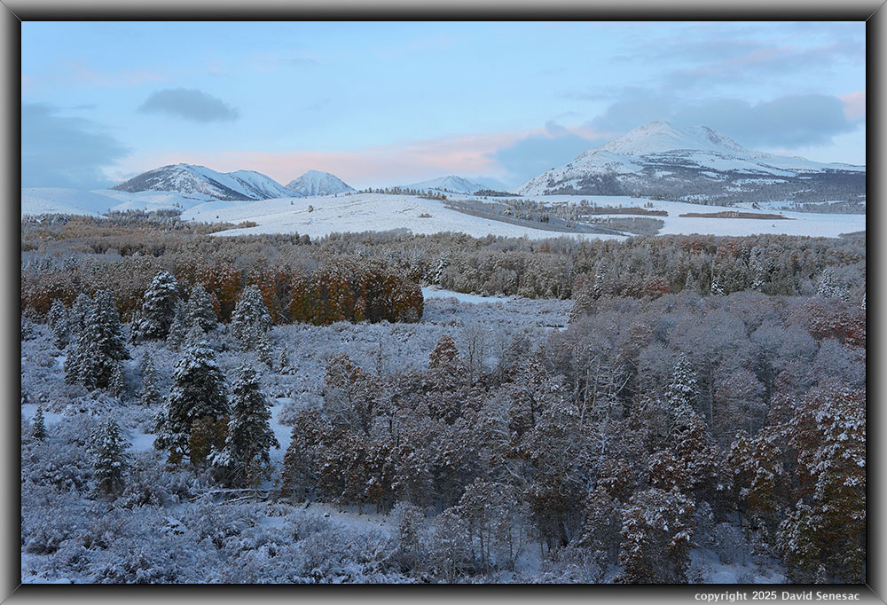
VA04082 4100x6150 pixels 1 frame 1 shot a6700 30mm
enlarged vertical slice view
About 2am Wednesday October 15, 2025, I could see stars through my windows. After a sound night of sleep, I awoke at dawn with a temperature 31F, then began preparing clothing and gear for sunrise photography at 8.1k Conway Summit. At the pass, several additional inches of powdery snow had been added during the evening. The temperature was a modest 28F with some thin clouds allowing preferred diffuse sky lighting. Off to the distant east, clouds blocked an early sunrise low on the horizon, but I was ready with tripod and camera set up to fire away when it popped over the clouds at 6:06 am PST. Parked legally off the highway lanes, right along the narrow highway guardrail, it is about 150 feet above the aspen groves. Trees and vegetation were captured in exceptionally fine detail due to the fresh snow contrast over previous bare ground and had an unusual dark brick-red appearance. Clouds still provided some decent pink color. The mountain at frame right is 12374 foot Dunderberg Peak.
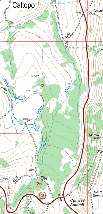
The quaking aspen grove north of Conway Summit at 8.1k feet elevation is the largest aspen grove visible along highway US395 in the range. It is currently under a special conservation easement with a comprehensive environmental report. The land's late 19th-century settlers, using Chinese laborers, channeled Virginia Creek to spread out, irrigating the meadows that provide ideal conditions for quaking aspen, Populus tremuloides, which only live 50 to 100 years. Though relatively young for tree species, the grove contains many spectacularly large trees that often have ancient knife carvings in its soft white bark.
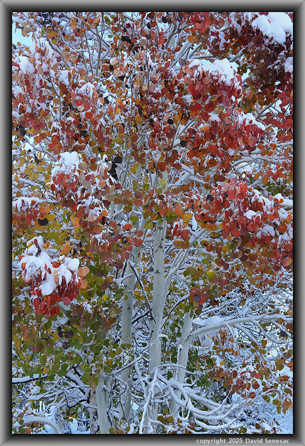
VA04120-34 4100x6150 pixels 1 frame 15 shot focus stack blend a6700 30mm
enlarged vertical slice view
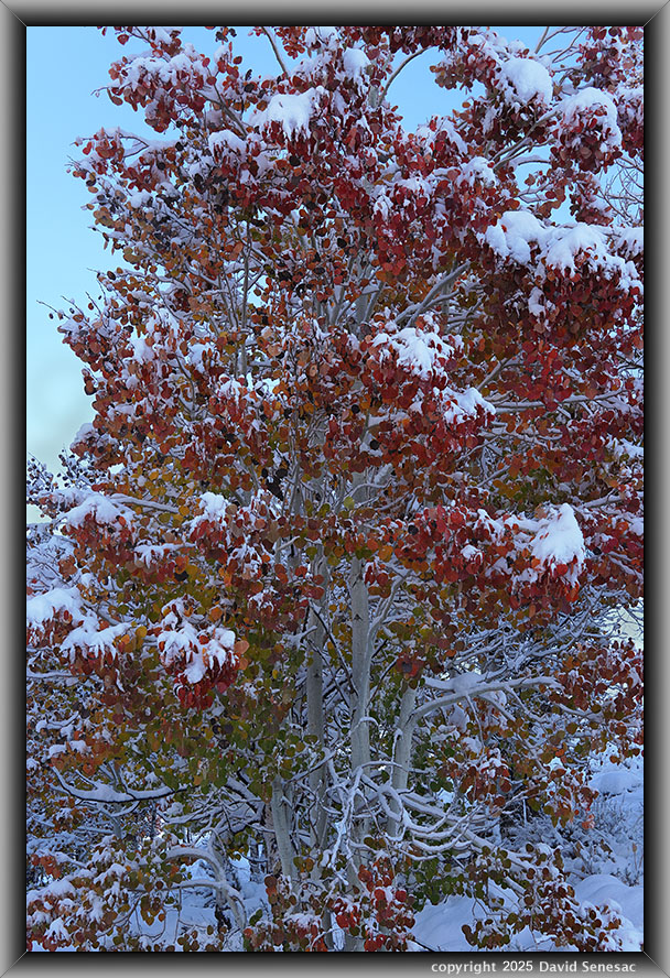
After 5 minutes, gear back in the car, I hurriedly drove south to park on the highway side near the top of a familiar 4WD road that was now buried in snow, thus requiring walking. Wearing old ski pants and my old Caribou Sorel boots, it took about half an hour to walk down the 200 vertical feet over a half mile in shin-to-knee-deep fresh powdery snow to my first subject at a small familiar grove along Virginia Creek that would remain shadowed longest. All along the 4WD route were fresh small rodent tracks I would have liked to have photographed, but I was much too intent on reaching more important subjects still in the better light of shadows. My second subject above, in diffuse cloud light and dead still air, was a near close-up single frame of 15 focus stack blended shots at an optimal Sigma DC DN 30mm F5.6 aperture, of a rare aspen with exceptionally red fall leaves, covered with fresh powder snow, that was worked at 7:01am PST. This was why I made the effort for the trip.
VA04135-43 4100x6150 pixels 1 frame 9 shot focus stack blend a6700 30mm
enlarged vertical slice view
Given my Sony a6700 focus bracket function, I can now crank off a set of such shots in seconds that in the past manually would have taken about 10 minutes. Thus, at 7:03am PST, I was already firing off my infrared shutter release for this next shadowed subject of the same tree, while backing away enough to fill the frame with most of the tree plus some blue sky.
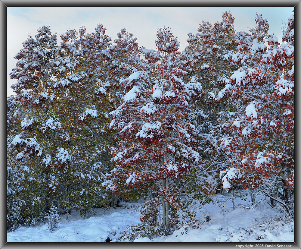
VA04151-04165-2x1v 7100x5800 pixels 2 column 1 row 2 frame 13 shot focus stack stitch blend a6700 30mm
enlarged vertical slice view
At 7:08am, I began firing away at this 2-column stitch blend of the same tree group that was a bit different from my first subject, not shown herein. Post-processing was later, back at home, a bit more involved as a slight breeze became active, requiring some Zerene Stacker editing work. Just a few minutes later, the sun began hitting the tops of these trees, so my timing reaching the grove early had been critical. The sunrise's sparse clouds quickly gave way to mostly sunny skies overhead that would end the better diffuse light.
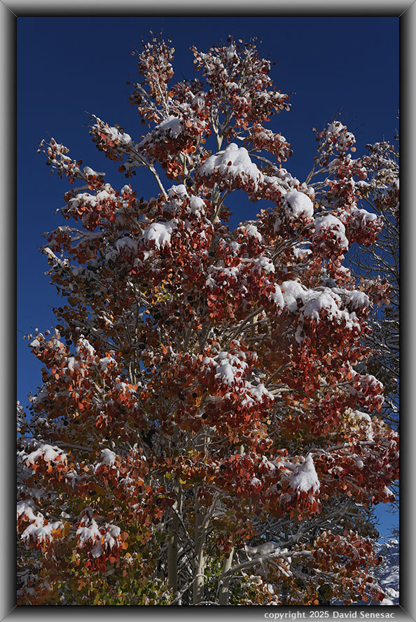
VA04217-23 7100x5800 pixels 2 column 1 row 2 frame 13 shot focus stack blend a6700 30mm
enlarged vertical slice view
After four in the sun subjects, at 7:40am PST, I worked the above image of the same tree per VA04151-04165-2x1v above, which shows the more contrasty, less aesthetic difference between shooting in diffuse light versus sunlight. The sky here was a beautiful blue, but the fine detail of snow and leaf features is superior in the less harsh light. Select the enlarged vertical slice view to more closely understand how that is true. Additionally, snow crystals on trees began to melt the instant direct sunlight hit the trees. After one more subject, I was done with this small area, so I hiked back up the snow-covered 4WD road that was a rather strenuous effort, step by step. Back at my car, I drove back to the same spot where I made the above sunrise shot.
Over the decades, I've never seen another photographer hike down to the main Conway Summit aspen groves, though I always do during fall trips. Thousands each year do stop, but just shoot from the highway roadside. This time would be more difficult than usual because the new snow was atop a steep slope of irregular big sagebrush. I regularly punched through snow to hollow vegetation underneath. Once down to the flats, there was a single familiar possible route through the dense sandbar willows in order to cross a small branch of Virginia Creek. As I approached the aspen grove, I rousted a big buck with a full set of antlers.
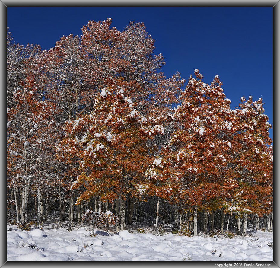
VA04256-04267-2x1v 6400x6100 pixels 2 column 1 row 2 frame 12 shot focus stack stitch blend a6700 30mm
enlarged vertical slice view
At 8:35am PST, I worked the above sunlit 2-column stitch subject at the main grove. The lumpy foreground was a result of knee deep snow atop clumps of big sagebrush. The whole grove, as shown in the dawn shot above, was dominantly an unusual brick red color I'd never seen in the past. Usually, the large grove is a mix of yellows, oranges, and greens, with a few trees a more reddish orange. For some reason, due to recent weeks of temperature and weather this year, almost all the leaves were this brick red, with a few leaves yellow-green. During most falls, only a few specific trees turn that color, while this event showed almost all the aspens potentially could change to that color given uncommon weather.
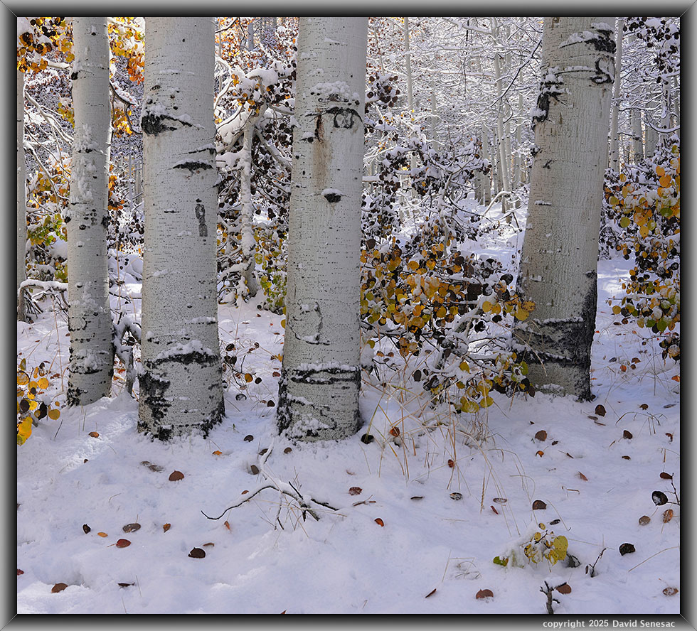
VA04275-04305-1x2h 6000x5400 pixels 2 column 1 row 2 frame 20 shot focus stack stitch blend a6700 30mm
enlarged vertical slice view
I went to a set of tree trunks; I first worked with a 4x5 film view camera in 2006. A nearby fallen tree required a different, closer tripod position to the trunks. At 8:45am with backlit sun on elements of the background, I was afraid of overexposure, but later at home I was happily surprised it rendered wonderfully. This was an uncommon 2-frame, 2-row stitch blend, as the majority of my stitch work uses the camera in a vertical orientation. The full image contains wonderful textures of the fresh snow crystals. Notice the black leaves that develop after fall leaves have fallen off and gone through their color cycle. Sometimes, especially cold fall events will turn leaves from green directly to black. Also, directly along stream channels where cold sumping night air will flow and where cold air pooling is blocked behind canyon narrows are areas where black leaves are likely to form still attached to trees. Not only do such leaves turn black, but if such leaves do have color, the backlit translucent quality may be reduced with a lower level of saturated glow.
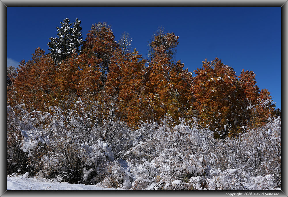
VA04321-24 6150x4100 pixels 1 frame 4 shot focus stack blend a6700 30mm
enlarged vertical slice view
The above image at 9:20am PST from deep in the grove shows a foreground of sandbar willow, Salix exigua, that hides a branch of the creek with aspen behind in brick orange-red color. The taller tree is a Jeffrey pine that dominates lower mountain areas of the eastern central Sierra Nevada.
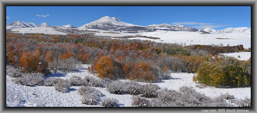
VA04330-04336-2x1h 9700x4000 pixels 2 column 1 row 2 frame 7 shot focus stack stitch blend a6700 30mm
enlarged vertical slice view
After much hurried walking within the now unaesthetic, quite contrasty sunshine grove, I decided to bail back to my car and drive US395 back north. I took a direct route to my car up the steep, snowy sagebrush slope and, along the way, for a breather at 9:45am PST, was quite surprised that the extensive landscapes to the west didn't look as harsh as I expected. So worked the above 2-column horizontal stitch blend with my 30mm, and in post-processing it came out surprisingly well. This old photographer is never too old to learn new things. In the background: Mount Olsen, Black Mtn, 12,374-foot Dunderberg Pk, and Kavanaugh Ridge. This 2025 summer, two of us backpacked 6 days semi-base camping in the spectacular Green Creek Basin behind Kavanaugh.
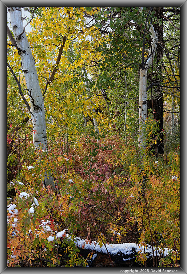
VA04365-79 4100x6150 pixels 1 frame 15 shot focus stack blend a6700 30mm
enlarged vertical slice view
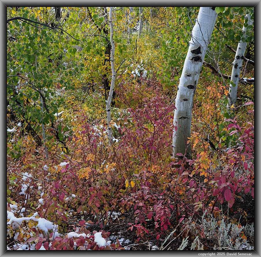
Back in the car, I noticed clouds moving in south of Conway Summit. I had really wanted to work areas along lower Mill Creek, so instead of driving north, I drove back south, and indeed, that area had a nice group of low-elevation clouds, possibly due to humid evaporation of relatively warm Mono Lake waters. So about 10:34am PST, I was down along the 2N14 dirt road beside Mill Creek where I worked a subject at the creek bridge. The above was my second subject at 10:37am PST that shows the interesting mix of fall leaf species, including a still well green quaking aspen, black cottonwood, Populus trichocarpa, creek dogwood, Cornus sericea, aka red osier dogwood, and wood rose, Rosa gymnocarpa. In just a few short hours, much of the fresh snow had melted at this 6.9k elevation. The diffuse cloud light was perfect.
The fragrant, flowering wood rose is common in lower eastern central Sierra Nevada riparian areas. At this time of year, wood roses with a light orange fall leaf color also show their red-hued hips that many animals and birds consume. Anyone considering working in zones like this needs to wear robust pants, as sharp wood rose thickets with sharp prickles are common.
VA04380-04409-1x2h 6000x5900 pixels 1 column 2 row 2 frame 29 shot focus stack stitch blend a6700 30mm
enlarged vertical slice view
This next, even better, 2 horizontal row stitch blend shot above was similar. The creek dogwood has a range of fall leaf colors, with these a more medium rose-red. Outside the creek zone, the light cyan-hued big sagebrush in the lower right of the frame dominates. A type of intimate landscape where the full image, given much detail, has much more aesthetic impact. This was the last subject I worked on before a slight breeze slowed shooting.
VA04504-13 4100x6150 pixels 1 frame 10 shot focus stack blend a6700 30mm
enlarged vertical slice view
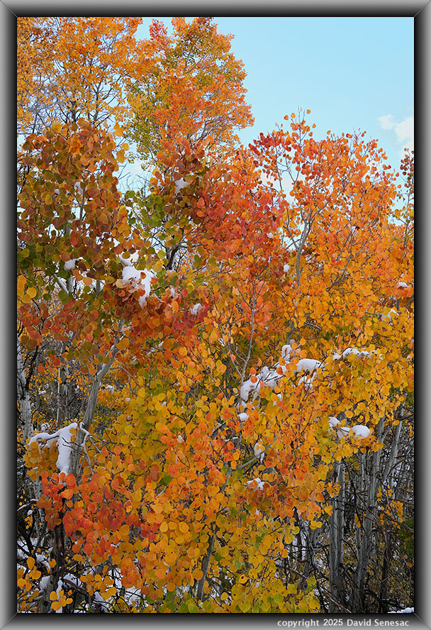
An hour and a half and a few subjects later, I worked the last subject along Mill Creek. The sun and a minor breeze were increasing, requiring waiting for cloud shading and breeze lulls. This tree group of probable root clones had the brightest aspen leaf colors in the area, indicating optimal leaf translucence, so I moved rather close for best leaf detail and waited for the sun to move behind a cloud. At 12:15pm PST, I was on my way north on US395.
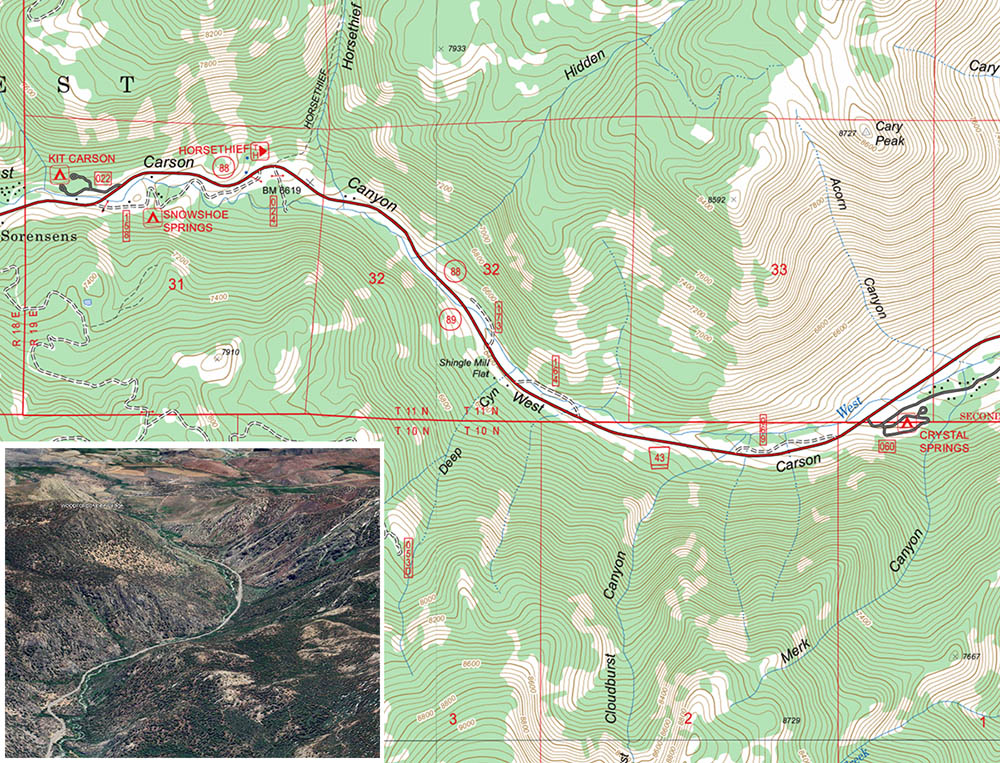
Other than topping off cheap gas in Gardnerville, I didn't waste time driving to my final destination, the West Carson Canyon between Hope Valley and Woodfords at 6700 to 6000 feet that I'd noted on the Monday drive. Although in the past, I'd worked fall leaf colors between Caples Lake and Hope Valley, I'd never even explored this lower area primarily because it tends to peak later in mid-October. Now having done so, I can state that it may have some of the best varied stream leaf color subjects in the range, with beautiful smooth granite boulders and bedrock at the river.
There is also an abundance of free dispersed camping available that isn't obvious until one explores the short stub dirt roads along the highway. The waters look perfect for trout; however, I didn't see a single fish that obviously has to do with being close to a lot of people living about the Carson Valley. So why is it little known among fall leaf enthusiasts? Well, aspen groves in Hope Valley are much more open to roadside views, and Sorensens (Now Desolation Hotel) was much more prominently advertised. Additionally, working fall leaf color along streams with dense trees and vegetation requires gymnastic bushwhacking skills and careful footwork atop often slippery river boulders.
Below 6840 on the south side of the river is the old Snowshoe Springs abandoned paved road. On both sides of the river at 6640 feet are 3 more abandoned old paved dirt road dispersed camping areas. The topo and forest service maps do not show some of the 8 abandoned deteriorating dirt roads below 6.5k, so the better way to understand what is there is to use Google Earth while also looking at various Caltopo Base Layers. GE has much better resolution than the Caltopo say NAIP satellite images, and its historical imagery can provide much other useful information.
If one prefers a regular National Forest Service campground with minimal facilities, at 5.8k is the Toiyabe National Forest, Crystal Springs Campground at $24 per night. Other than highway vehicle noise, this river highway zone is arguably one of the best choices to disperse camp in the range because it is right beside a beautiful section of lower-elevation granite geology, an all-year river, and plenty of nearby driveable zones within an hour of camp.
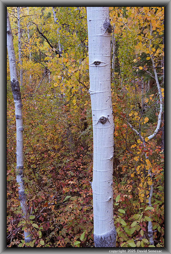
VA04522-38 4000x6100 pixels 1 frame 17 shot focus stack blend a6700 30mm
enlarged vertical slice view
I worked this first subject above, a bit before 2pm PST in canyon shadows with the sun high on canyon walls. Many of the following subjects are difficult to reach due to the undergrowth. Here, I gingerly walked out on a huge fallen Jeffrey pine log, looking a bit downwards. A bit of snow remained, showing it did receive snow during the storm. A busy frame with quaking aspen, creek dogwood, and wood rose, anchored by the nicely white aspen trunk providing a sense of how awkward and enveloping it would be to attempt to move through.
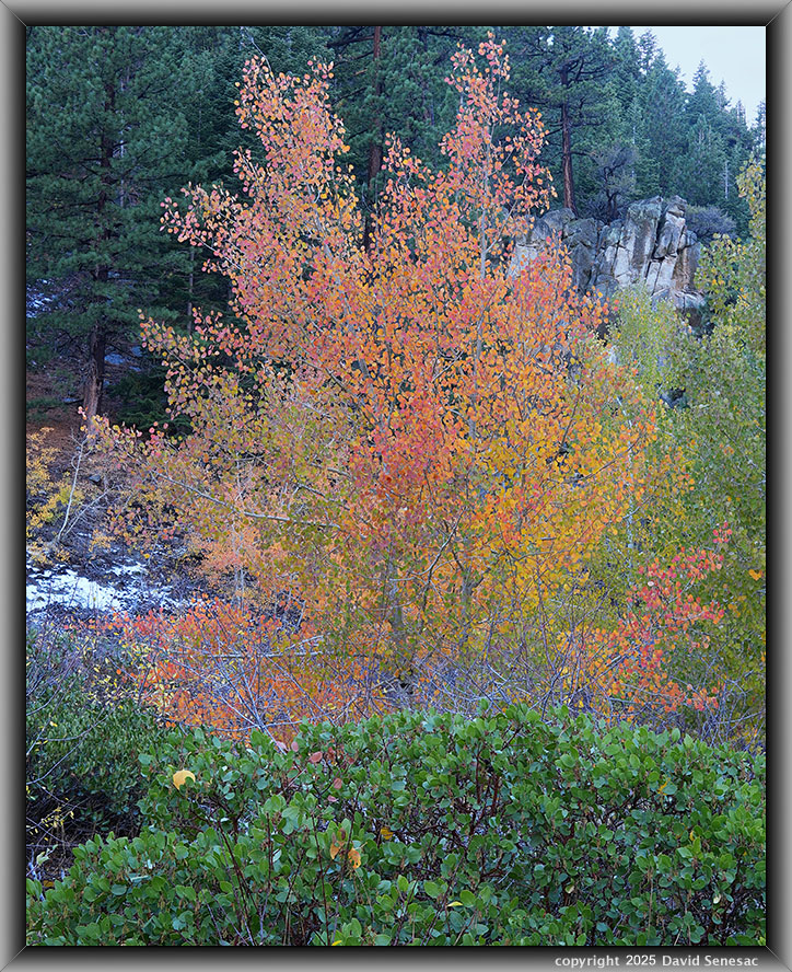
VA04563-75 3700x4600 pixels 1 frame 13 shot focus stack blend a6700 30mm
enlarged vertical slice view
The above subject was off a spur road on the shadiest, south side of highway SR88. The variable fall leaf colors with excellent separation against a darker background are about as good as mixed colors get. A manzanita provides a nice lower foreground. Most conifers in the background are Jeffrey pine, Pinus jeffreyi. For a better view of the exceptional pink leaf colors, select the enlarged vertical slice view.
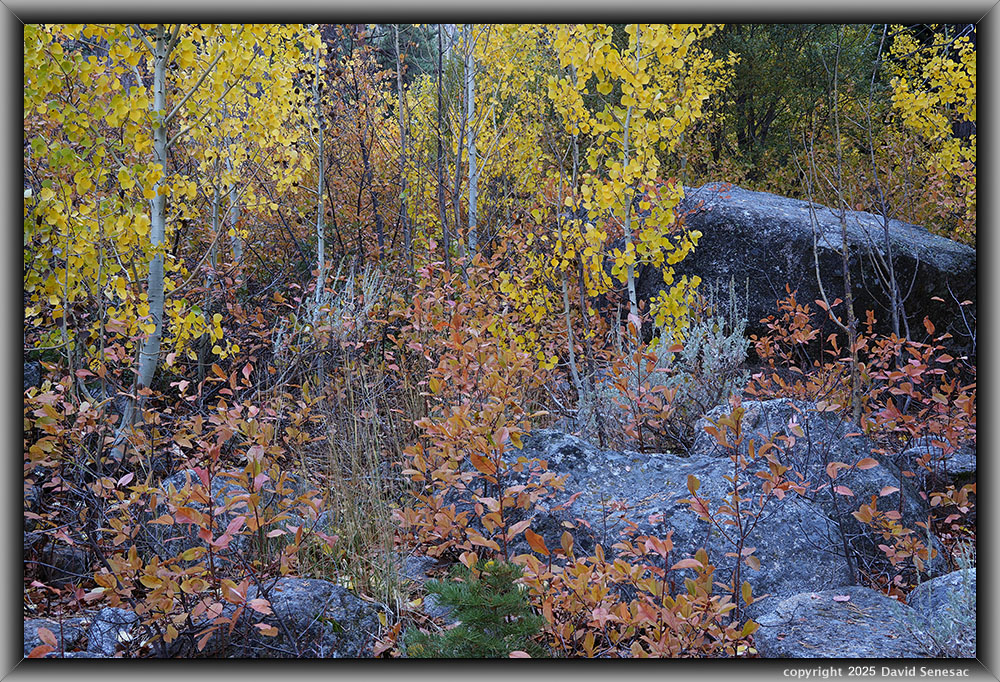
VA04634-43 6150x4100 pixels 1 frame 10 shot focus stack blend a6700 30mm
enlarged vertical slice view
At 4:14pm PST, I worked the above modest subject with quaking aspen, big sagebrush, creek dogwood, Jeffrey pine, and white fir. The dogwood fall leaves had an interesting flesh-colored hue and may, in fact, be a different species, brown dogwood, as the branches were not mostly red. The baby tree at the bottom is a white fir. Notice how all the granite rocks have a dark lichen coating. Near the river, many boulders are also moss-covered.
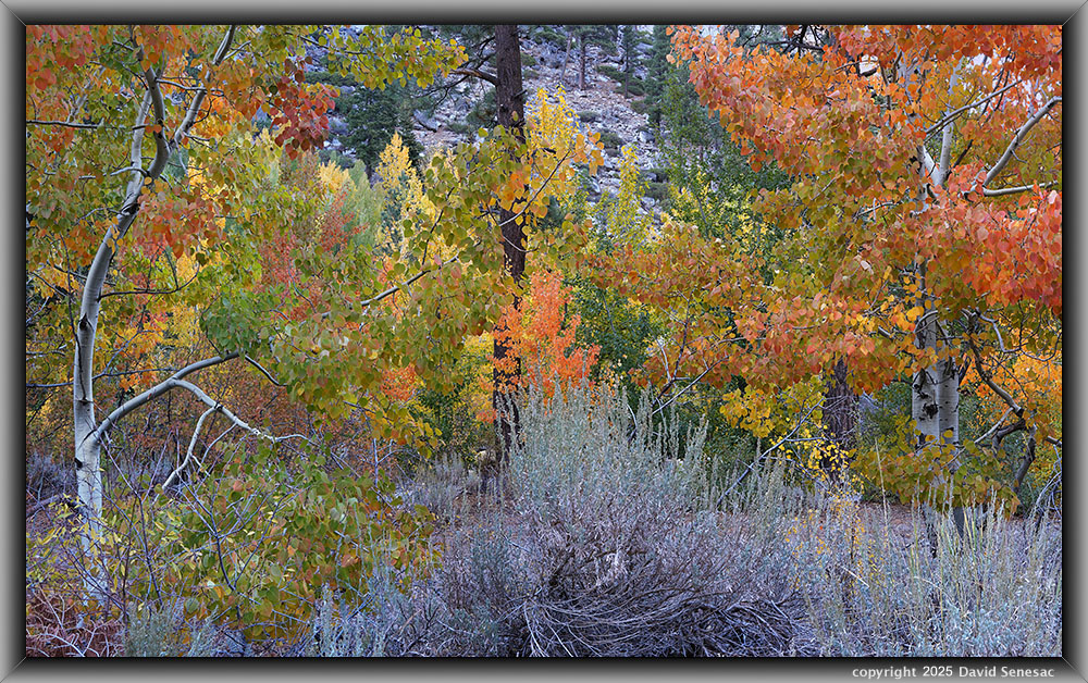
At page top is my strongest aspen image of the trip, shot at 4:21pm PST. I liked how the two near aspens frame several different background tree leaf colors. At center foreground is a big sagebrush, Artemisia tridentata, plant. Directly behind the sagebrush and lower is a 4wd road leading to the lowest elevation dispersed campsite in that area. Note the dark Jeffrey pine trunk at the center helps divide the two frame sides. I patiently waited about 20 minutes for breezes to lull before depressing my infrared shutter release button. To better understand the value of focus stack blending at F5.0, look at the detail in that page top image's enlarged vertical slice view.
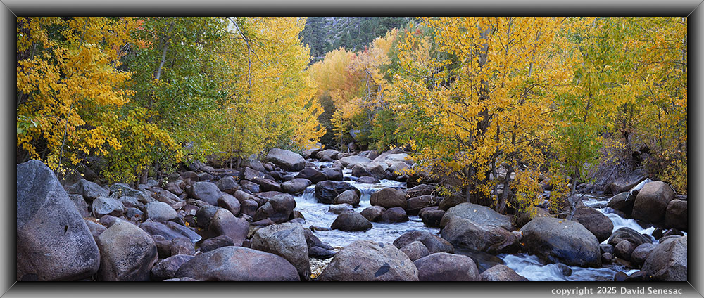
VA04686-04709-2x1h 9100x3600 pixels 2 column 1 row 2 frame 8 shot focus stack stitch blend a6700 30mm
enlarged vertical slice view
At 4:29pm PST, the West Carson River presented a wide river landscape with black cottonwood, Populus trichocarpa, creek dogwood, willow, Salix sp, Jeffrey pine, and manzanita in the distance on the dry, south-facing canyon slopes. Love all the river-smoothed granite boulders. The river level was, of course, higher than usual due to the storm runoff that added impact. This would be the last subject that I worked on Wednesday, less than an hour before astronomical sunset. I settled on a quiet dispersed camping night along the river where I enjoyed eating a can of Campbell's Spaghetti O's, cooked at dusk on my MSR backpacking stove, then eaten comfortably prone within my down sleeping bag, warmed, dome light illuminated vehicle interior.
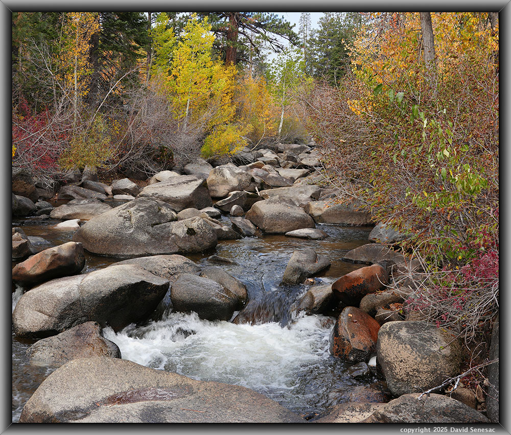
VA04776-4798-2x1v 7100x6000 pixels 2 column 1 row 2 frame 23 shot focus stack stitch blend a6700 30mm
enlarged vertical slice view
I was up at dawn on Thursday October 16, 2025, soon moving gear around in the car. It was important to get any subjects captured before harsh sunlight reached the canyon bottom. I needed to explore the river above the highway's 6.4k river crossing, which required some time because it required thrashing through much awkward undergrowth and fallen-log terrain. The sun this morning was moving right at the south ridgeline of this deep, generally east-to-west-oriented canyon. This first subject above was worked at 7:44am PST of the West Carson River with quaking aspen, black cottonwood, creek dogwood, willow, white fir, Abies concolor, and a large Jeffrey pine, Pinus jeffreyi, at frame center top.
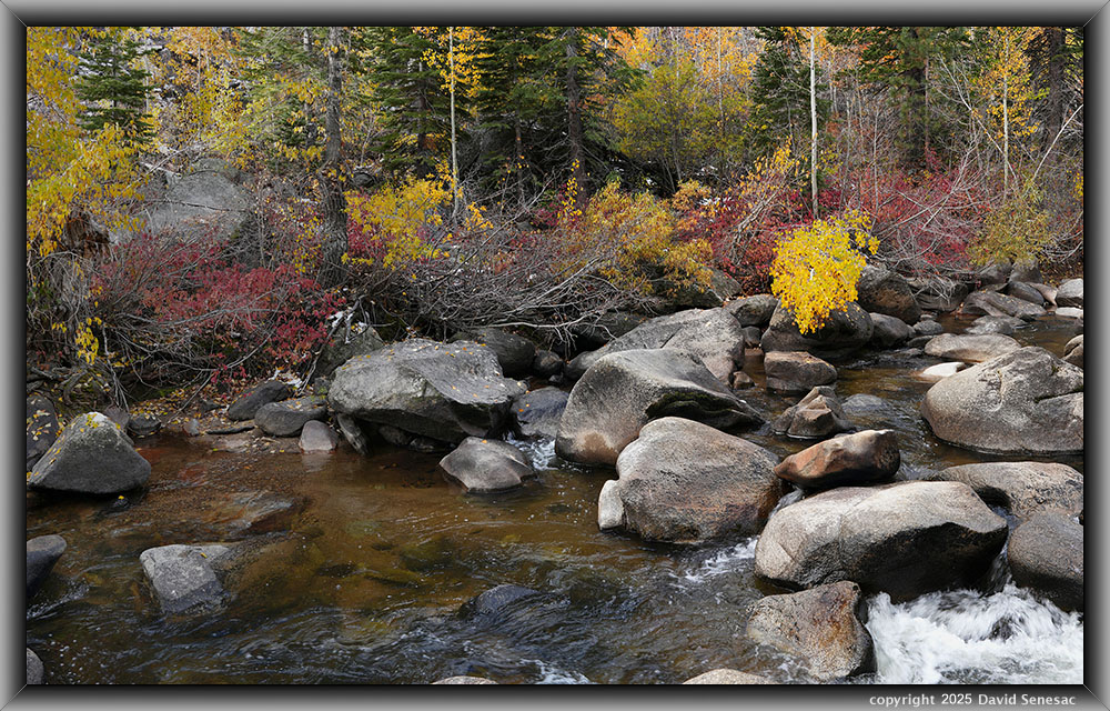
VA04820-4836-3x1v 9800x6100 pixels 3 column 1 row 3 frame 17 shot focus stack stitch blend a6700 30mm
enlarged vertical slice view
At 7:53am, I worked my second and last subject of the road trip, a similar West Fork Carson River subject with quaking aspen, black cottonwood, creek dogwood, willow, several white fir, Abies concolor, upstream, and Jeffrey pine. Notice the patches of snow still on leaf vegetation. And it was the best river image of the trip. After completing exploration upstream, I drove back down to the lower canyon to capture a wall of dogwood and aspen leaves that simply had too much breeze movement for focus stack work, so I was not successful. I began my long drive home at 9:20am PST that took about 4 hours.
After post-processing was completed days later, I was pleased the trip had been even more productive than expected given rather difficult weather conditions. The snowstorm adventure itself within the new car was an interesting educational logistical experience. I feel that coming into 2026, I will be able to safely make some rather long road trips while living in the Trailblazer, including those out of state. I was also glad to have finally explored the lower Carson River Canyon, which I will do more of in the future.
NEXT: Page 7 Calaveras Big Trees State Park
2025 Trip Chronicles: Contents



















