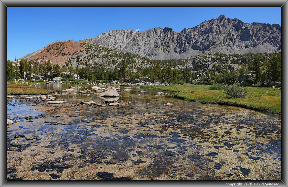
VS00431-00450-3x1v 9000x5700 pixels 3 column 1 row 3 frame 20 shot focus stack stitch blend a6700 17:40mm at 26.0mm
enlarged vertical slice view image text section
NEXT: Page 12 SF Bishop Creek Backpack 8/11 2of2
2026 Trip Chronicles: Contents
SF Bishop Creek Backpack 8/11
SF Bishop Creek Backpack 8/12
SF Bishop Creek Backpack 8/13
SF Bishop Creek Backpack 8/14
My 2026 backpacking season has gone much like my 2025/2026 winter ski season. Instead of one or two short warm-up backpacking trips, until August, I only managed a few days of day hiking about Ebbetts Pass. On an early July afternoon on the recreation dot gov wilderness permit reservation site, I found 5 quota spots had opened up for the Bishop Pass trail from South Lake, apparently when another group had cancelled. Otherwise, 60% of the popular trail's quota had been fully reserved for 6 months. The added 14-day quota releases of the remaining 40% of quotas had been taken up unfairly in minutes each morning at 7am using software that automates that process, much like with music concert tickets.
So yeah, I snagged a permit for 2 of us for July 24. The weather forecast was showing optimal sunny, low-wind conditions, while the timberline environment was perfect for aesthetic conditions with peaking midsummer greenery and wildflowers, plus plenty of lingering snow patches on shadowy slopes on high peaks that rise to over 13k feet with ephemeral streamlets across the landscape.
My brother J and I planned, prepped gear, and packed up for the trip. However, just after I arrived at our join-up point in Tracy, about 60 miles into my route, his long-time common-law wife D suffered life-threatening gastrointestinal hemorrhaging, resulting in several days in a hospital. I returned home and unpacked gear, with J attending to D. A year earlier, she had been given a year to live, primarily due to cigarette smoking, alcohol, and years of stimulant drug use. Modern medical care brought D back from that brink, and she convalesced at J's residence with nurses visiting regularly.
We next began looking at a mid-August trip somewhere, and that was expected to be West Lake in the Green Creek basin as there were plenty of open quota slots for most of the Hoover trailheads. In early August, I once again lucked out finding a sudden open date in the mid-afternoon for Bishop Pass, after a group cancelled. So, I immediately reserved that for a 5-day trip.
Thus, on Tuesday, August 11, 2026, I left mid-morning for Tracy, where this time brother J synced up with me where we left his van, as we continued the rest of the 290 miles in my vehicle. I stopped in Oakdale for gasoline and a bit of first-day trail food. By 6pm, we had reached the South Lake trailhead parking lot within Inyo National Forest that is usually full by mid-morning. As expected by arriving late in the day, there were plenty of parking spots available as day hikers returned and drove off. After being thorough with packing and preparation for the July 24 start, my follow-up gear packing had not been thorough. Given that we arrived a bit later than expected with sunset approaching, I didn't bother to go through my long Excel gear checklist. During the trip, I would find a few minor items missing. For instance, I did not add a couple of extra Kleenex tissue packets from my car supply, so I would need to rely on the couple that were already packed and had only one good butane lighter.
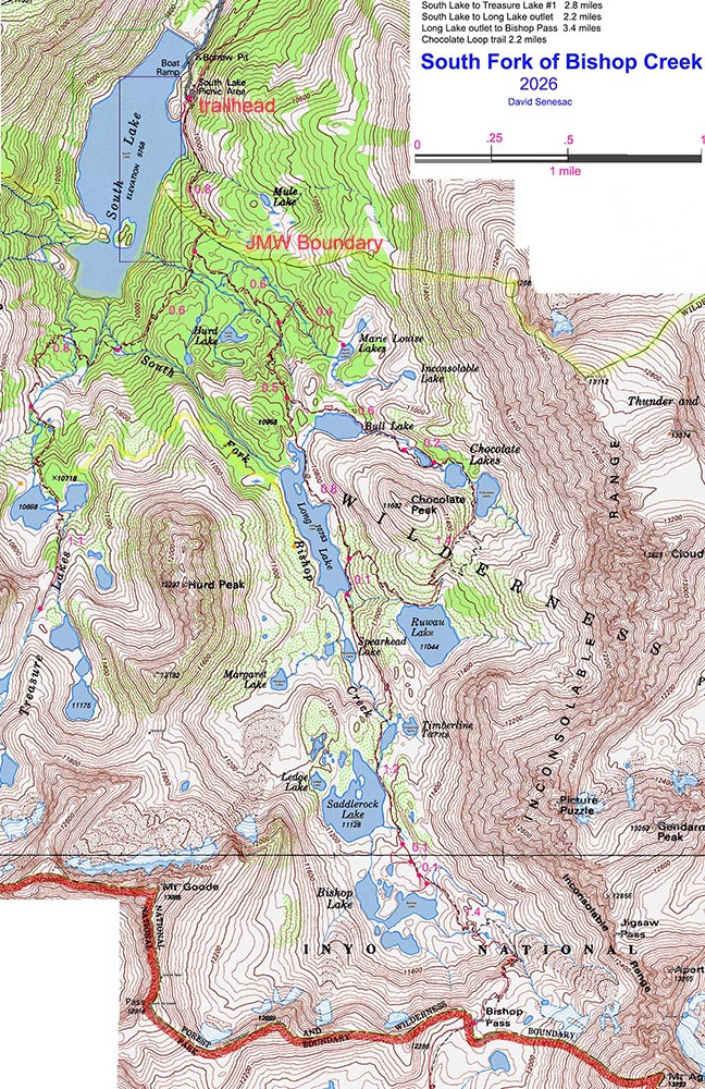
Although our wilderness permit began on Wednesday, August 12, we could legally hike in about 0.8 miles up 400 vertical feet to just outside the John Muir Wilderness boundary to camp this first night. Thus, our trip was actually 6 days. That would leave 2 miles the next morning to reach our Long Lake semi-base camping destination. Unlike the sunny July dates, thunderstorms had been occurring for a few days, and forecasts showed that would continue at least through Thursday. So, my expectation was that my highly detailed itinerary would need to change due to my not being able to work priority landscape photography subjects.
About 6:40pm we headed off on the wide trail along the east shore of South Lake that is actually a dammed reservoir atop what had once been a small lake along the South Fork of Bishop Creek. Both our carrying weights were about 63 pounds, or 45% of body weight; that is a crushing weight for anyone, much less a 140-pound, 77-year-old man. My extra weight was due to photography gear and J's due to extra fishing and heavy new cooking gear that we were willing to endure over the short distance. The trail surface was freshly washed by rain, while somewhat clearing skies pointed towards no more showers. I had never seen a trail so covered with fresh horse road apples that meant regularly NOT STEPPING on any. Unlike the nearby Lake Sabrina trail, the trail immediately climbs up, which had us stopping frequently any place rocks or logs afforded a seat. The only way I can cope when carrying such a heavy load. Note, the majority of such stops are less than a minute.
After a near-level mid-section, the final section with many rock step-ups veers away from the reservoir up a small side canyon, then exits up a switchback where the boundary resides. The two early season streamlets flowing off the Inconsolable Range ridge were, as expected, dry. Thus, we had to carry in enough water for this one night, which in my case was maybe 8 ounces of water.
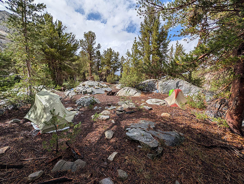
Since both of us had not physically prepared for the effort like we normally do, we were glad about not having to make this hike the next morning. With the sun set, it didn't take us long to set up our tents and gear, then get inside our solo tents. Given the strenuous effort causing overstressed muscle awareness, I did not sleep well, tossing and turning much of the night uncomfortably. A couple of other groups late-day hiking passed by on the nearby trail as we set up our camp. Unlike the majority of backpackers using this trail, we would not be going over Bishop Pass, which is at the Kings Canyon National Park boundary at 5.6 miles, and instead would remain all 6 days within the upper South Fork of Bishop Creek basin of the John Muir Wilderness, in what I term a semi-base camping backpacking trip. After arriving in camp, my hiking polyester shell front zipper slider cracked in half. So would need to instead wear my heavier, robust Columbia rain jacket most of this trip.
A semi-basecamping backpacking trip type is one in which one hikes with gear into a destination zone, then may overnight at specific camp spots for single to multiple days, with each camp within a short distance zone. The reason I move from a single basecamp is to be able to access photography subjects more efficiently. For example, a dawn lake reflection subject is best accessed from a nearby camp spot versus having to travel pre-dawn in darkness with a headlamp. On my trips, it is about the Destination, not the Journey. On a basecamping trip type, one remains at a single base camp. That is what many equestrian trip groups are limited to, then day-riding horses on trails to nearby places of interest.
Conversely, on most traditional backpacking trips, groups hike significant distances from mid-morning to late afternoon, then camp at a new spot each night. Such trips are about the Journey, not the Destinations. If such groups do spend a couple of nights at one location, they call such a layover day, while long-trail thru-hikers call that a "zero day". Not a productive style for serious photographers because optimal times of day for sunlight on landscapes are rarely when a group may be passing by on trails of whatever subjects. Additionally, these zones are often immense; merely passing through briefly on trails hardly allows one to experience such places. That is, of course, fine for their intended interests, where they might in passing be content to snap a modest photo for the record and memories.
We were up packing our gear before sunrise on Wednesday, August 12, 2026, then on the trail at 6:40am. Astronomical sunrise was at 6:07am PDT and sunset at 7:49pm PDT. The first mile routes up through rocky, shady, lodgepole pine forest. It quickly splits with a right trail branch heading to Treasure Lakes that I'd visited in 2024. During that trip on day 3, I did a somewhat difficult cross-country route around the north end of Hurd Peak to the same Long Lake camp spot we were headed to this day on the west, non-trail, rarely visited side of Long Lake. Over the first mile, the trail does go across 2 small streams draining Mary Louise and Hurd Lake drainages, where water is available. It was obvious from the start that today's thunderstorm forecast by late morning was accurate. Numbers of other groups and then day hikers passed we turtles by. My heavy load felt less unpleasant after the night of rest, though we still stopped for brief rests at every chance.
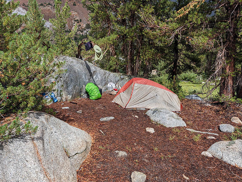
At the north end of Long Lake, we took the use trail west towards the outlet. At the outlet, the slippery, wet-from-rain jumbled log crossing was difficult given our heavy packs, as I went into crawling-on-all-fours mode. Though the lake's west side does not have a use route, I was familiar with an efficient route across its sunny benches. By 10:40am we arrived amid occasional sprinkles, a 2-mile, 600-foot vertical-gain effort. After setting up camp per images above and then cooking a light lunch, this weary, sleep-deprived, altitude-low-oxygen, not-yet-adapted person was not too lively, so I took a long nap. A fresh water supply was from an ephemeral streamlet about 40 feet away.
About 2pm, I awoke, somewhat groggy. We decided on an exploratory day hike towards Margaret Lake, about a half mile away via irregular terrain. J meanwhile had been fishing and caught a few pan-sized trout. The hike would help me figure out some strategy for the next morning's photo work. We found the best route down into a deep ravine and in a short time reached the lake. Not much later, about 5pm, thunderstorms that had been around our zone all afternoon began attacking with bouts of lightning, hail, rain, cooler temperatures, and gusts of downdraft wind. We made our way back to camp by moving during lulls in the rain, tree to tree, of densest whitebark pines. However, some of the worst wet hail caught us out in the open. Since I was wearing my rain shell, I wasn't that wet, but lightning always scares me.
During a lull in the storms, we escaped a bit from our tents. As it was near dead calm at times, lake waters were nicely calm. So snapped a few Pixel 10 Pro shots. The dry, wet grasses had a particularly nice bright blond glow. In late afternoon, we retired early into our tents, where I had a second restless night trying to sleep. Well, I slept a few hours, then was awake again for a long time in the wee hours.
We were up early, Thursday, August 13, 2026, excited to make the most of our first full layover day. My body hardly felt any of the previous two days of pack-lugging effort. Long Lake is in a deep north-to-south-oriented glacier-carved canyon with tall peaks on each side. Thus, it requires some time for the sun to rise above the towering Inconsolable Range. Since I needed to wait, I first went down the 70 vertical or so feet to the lake to fish a bit. Cloudy skies to the east, where Mexican Monsoon flows move north along the range, indeed looked like thunderstorms would again soon arrive by midday. In a short time, while spinning reel casting Kastmaster lures, I managed to catch 3 pan-sized eastern brook trout that I safely released. That was enough to show me I could probably catch more later at will. I had brought along my own frying pan instead of relying on J's. That was poor planning, because the basin had far too many strong photography subjects for me to spend much time fishing.
VS00152-00165-3x1v 7000x5000 pixels 3 column 1 row 3 frame 12 shot focus stack stitch blend a6700 17:40mm @17.0mm
enlarged vertical slice view
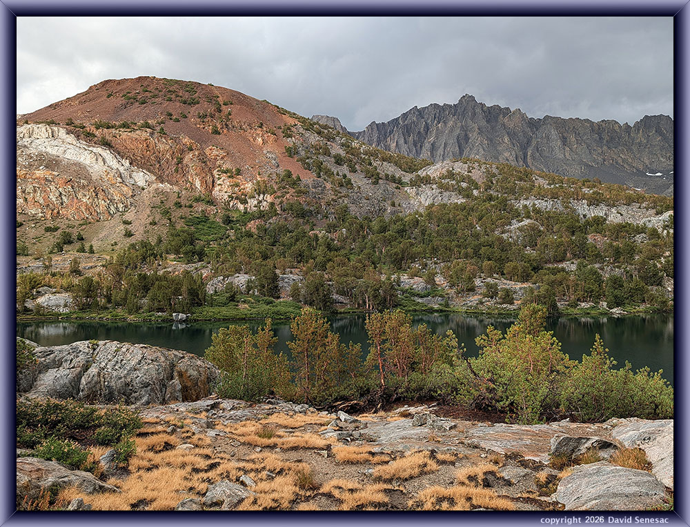
Back at our camp, I grabbed my photo gear, then headed to Margaret Lake. The upper atmosphere wind-flow was from the southwest, a common summertime pattern that tends to develop afternoon thunderstorms. That flow was moving over Bishop Pass at 10k feet, 2 miles distant, then causing downdrafts on the lake waters; I could see it was never going to calm up for any reasonable reflections. Thus, looked for other types of interesting lake subjects. This first subject above, towards the southwest, was as calm as it got and shows a nice underwater section of rock that had plenty of green organics on its surfaces. In the background is 13,085-foot Mt. Goode that, over thousands of years of occasional rocks and boulders breaking off its steep eastern and northerly aspects, has provided a large rock glacier behind the lake. This rock glacier also includes some permanent snowfields. Well beneath the surface boulders are areas of water and ice that help lubricate its resistance to gravity flow downward. Note the face where rock is tumbling over a steep slope, as top layers of boulders move more readily than those below, creating a very unstable, moving bulging front.
The above 3-column stitch blend at 8:44am PDT was my first Sony a6700 subject of the trip. Note: all my work is also focus stack blended with this image from 12 individual shots from actuating Focus Bracket mode 3 times. On this trip, I was mostly using, for the fourth time, my expensive new Sigma 17-40mm DC ART zoom lens that I expected, given glowing lens reviews, could replace my 30mm and 16mm primes. Unfortunately, post-trip, I became disappointed with the continued softness of the results, particularly at the 40mm telephoto end, so henceforth I will go back to only using sharp prime lenses for Focus Bracket mode work. Part of the softness was due to the way the a6700 uses the provided lens information in that mode at infinity distance stopping points. In Focus Bracket mode, the a6700 is supposed to stop a sequence of shots when it reaches the infinity distance. However, too often with this lens, it stops near infinity at less than a critical focus it could have ended with. Thus, lost a few subjects post-trip after noticing soft focus results. Note: my 17-40mm lens zoom settings are taken from EXIF header data.
VS00183-00191-3x1v 9400x6100 pixels 3 column 1 row 3 frame 8 shot focus stack stitch blend a6700 17:40mm @20.8mm
enlarged vertical slice view
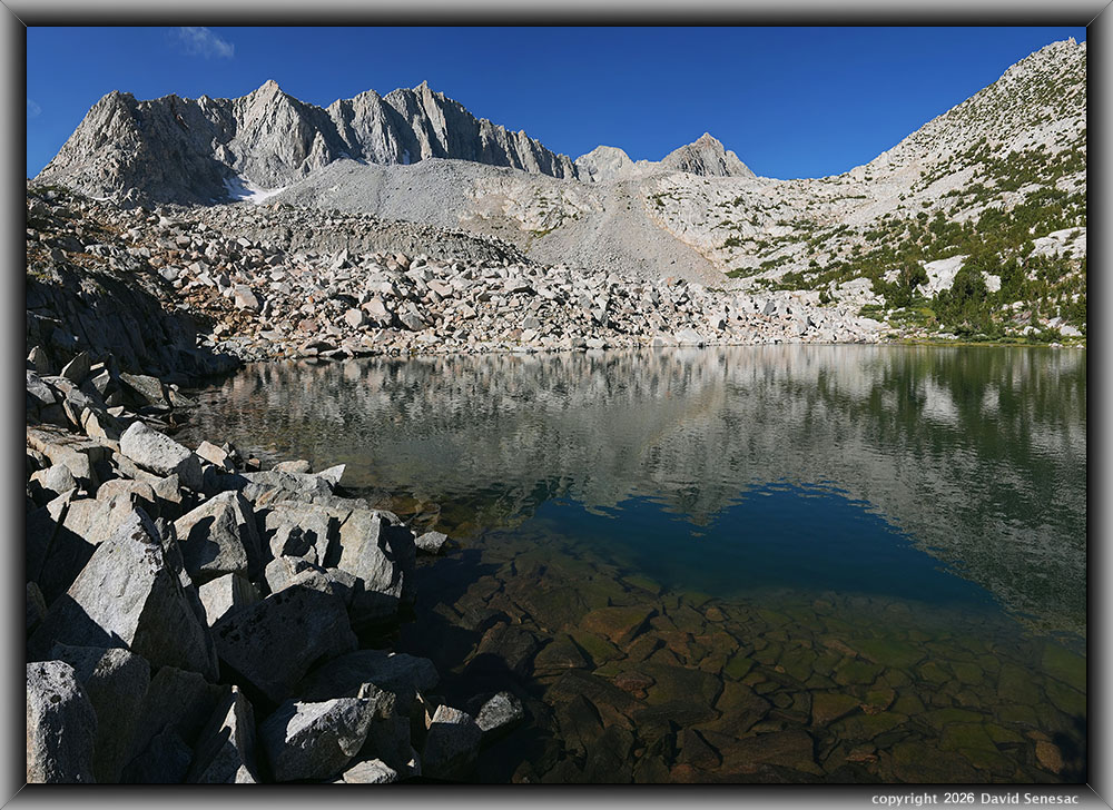
For this next image above at 9:01am, I climbed southeast a bit above the lake for this northwest view towards 12297-foot Hurd Peak. Margaret Lake is about 1/3 mile away and 150 feet above the main Bishop Pass trail. It is infrequently camped at in this era but was more so decades ago when horse packing was more active, and wood fires were legal. This timberline lake and its modest all-year stream below contain mostly small eastern brook trout. Our camp location was frame-right of Hurd. Almost all trees in this view are whitebark pine, Pinus albicaulis, which, besides its common mature taller form, per trees at the right frame edge, also have a stunted "Krummholz" form, common on avalanche slopes, as all those small green patches on the image show. The height of such trees is an indication of winter snow depths, as any branches poking up above the snow may break off due to exposure to wind and/or avalanching snow.
VS00208-00218-2x1v a6700x6100 pixels 2 column 1 row 2 frame 11 shot focus stack stitch blend a6700 17:40mm @25.2mm
enlarged vertical slice view
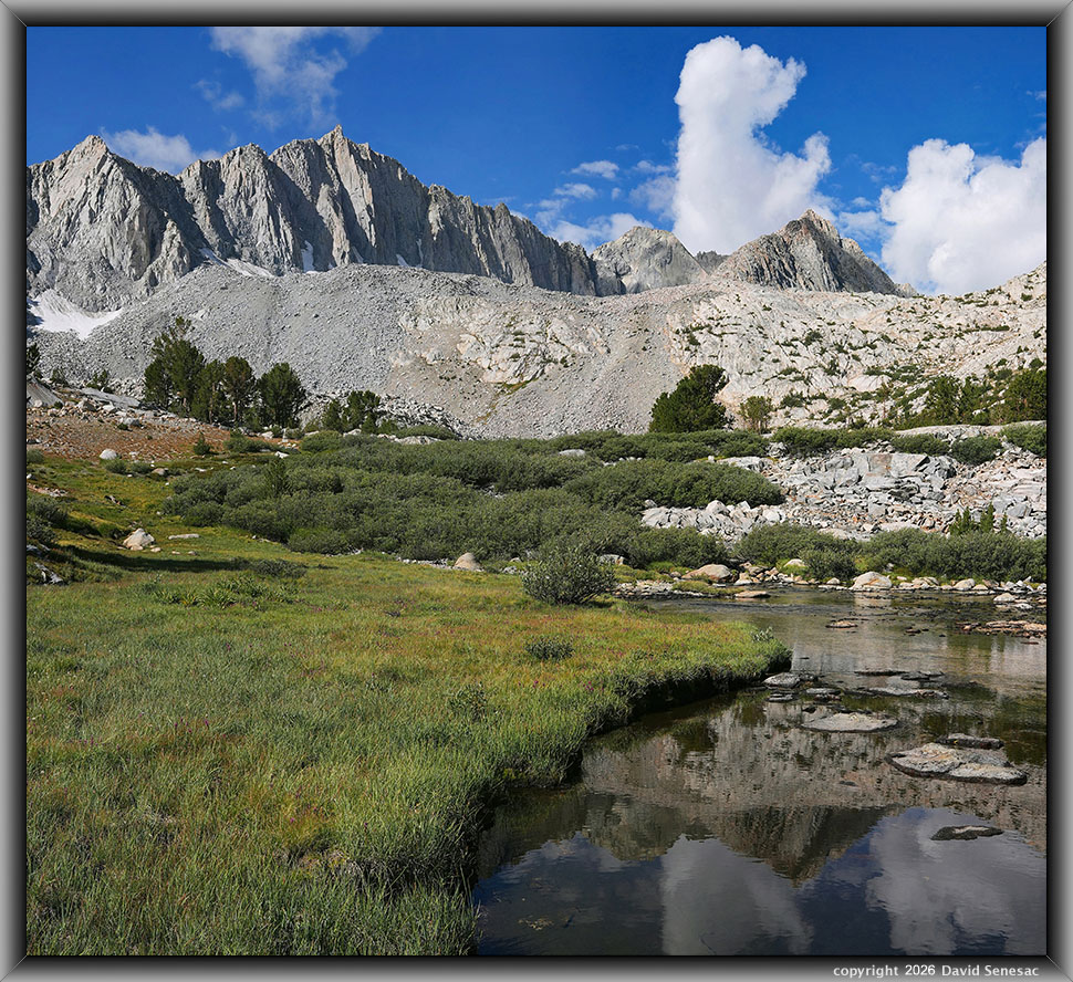
I went down the Margaret Lake outlet creek to an aesthetic shallow stream section where, at 9:21am, I worked this above image along its turfy edge. The turf meadow had many magenta-hued Lemmon's paintbrush, Castilleja lemmonii, one of the few late-season wildflower species still in bloom. View the enlarged vertical slice view to see those small flowers in greater detail. Mid-frame along the stream are masses of Sierra willow, Salix orestera, which is the most common Sierra Nevada willow species at mid-forest to timberline elevations. Its low height is the result of being below usual winter snow depths that protect its branches from winds. Note the cumulus cloud that looks like a begging dog.
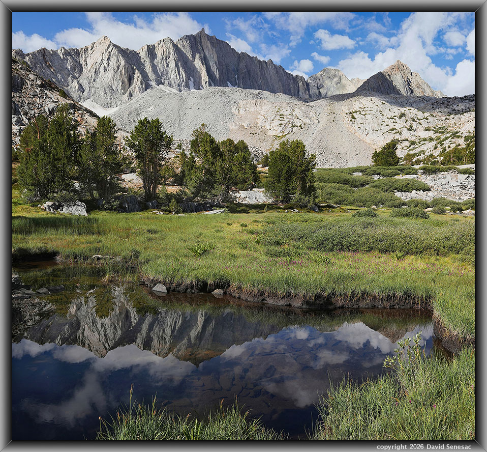
VS00219-00232-2x1v 6500x6000 pixels 2 column 1 row 2 frame 14 shot focus stack stitch blend a6700 17:40mm @23.1mm
enlarged vertical slice view
At 9:32am, a southwest view of a small pond in a marshy section of the meadow. Note how quickly clouds were now building. The other side of Mt Goode, which is on the Sierra Crest, is the boundary of Kings Canyon National Park, where water eventually flows into the Pacific Ocean, while waters on this side flow into the Owens River that ends up in the Mojave Desert or some Los Angeles water faucet. Such small bodies of water are good locations for better water reflections on breezy days, as their surfaces calm up rapidly. Note the dense areas of Lemmon's paintbrush. The mid-frame 30 to 50-foot-tall whitebark pines are the same species as those stunted forms on avalanche slopes.
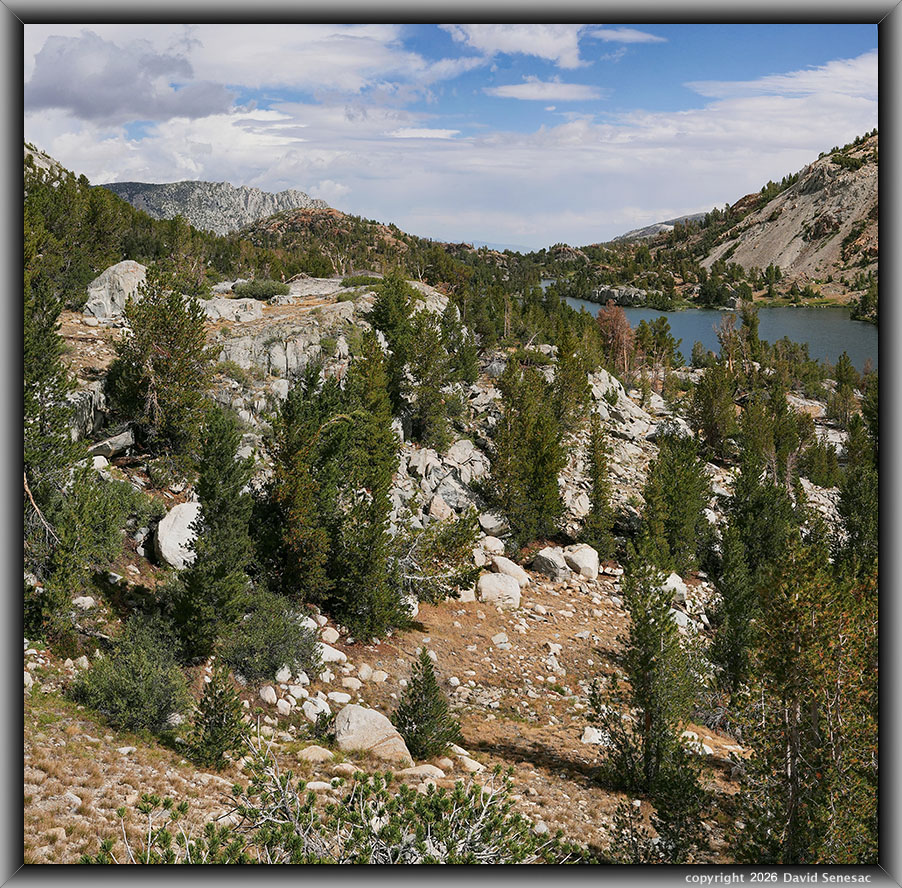
VS00253-00268-2x1v 6100x6000 pixels 2 column 1 row 2 frame 14 shot focus stack stitch blend a6700 17:40mm @28.5mm
enlarged vertical slice view
While I rambled back towards camp, I visited this lake overlook south of our camp for a southward view at 10:07am, with thunderstorms now threatening. Note how much of the grasses and herbs on this east-facing slope are a dry blond color that would have been green till mid-July. Another less-common species about the lake at the top of its elevation range that may look similar to whitebark is lodgepole pine. Lodgepole pine needles usually grow out of branchlets in groups of 2, while whitebark pine needles are usually in groups of 5. The white rocks are all granite geology that dominates the range but is less common in this local metamorphic zone.
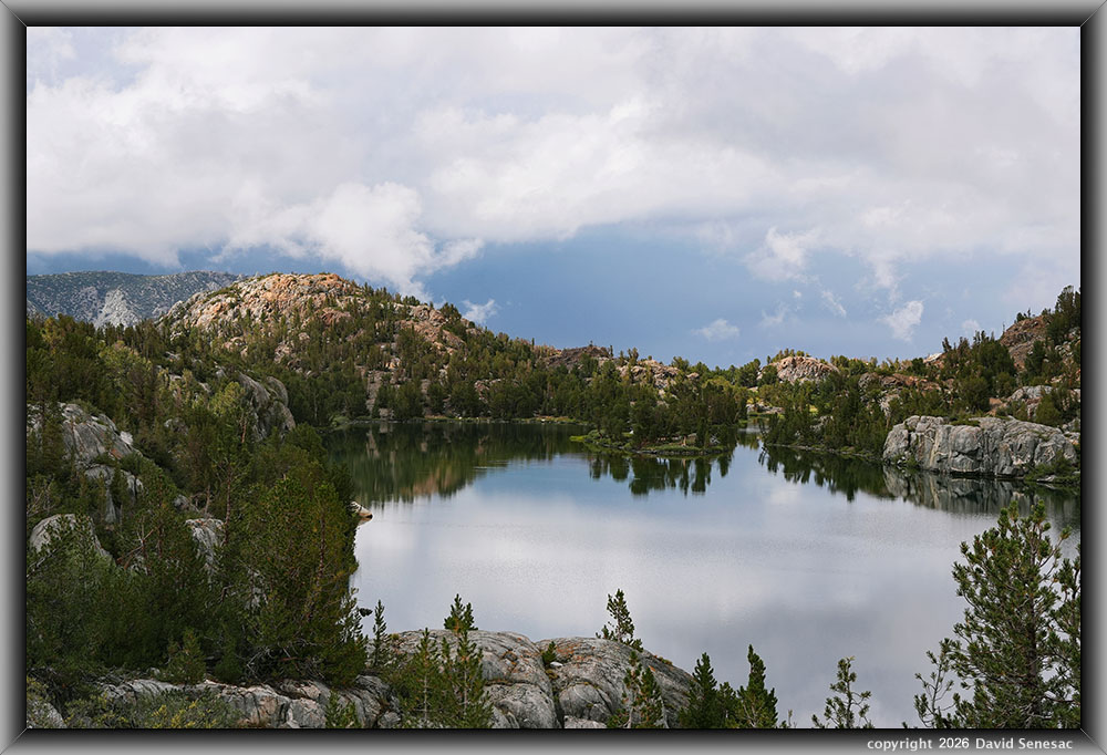
VS00273-76h 6150x4100 pixels 1 frame 4 shot focus stack blend a6700 17:40mm @32.4mm
enlarged vertical slice view
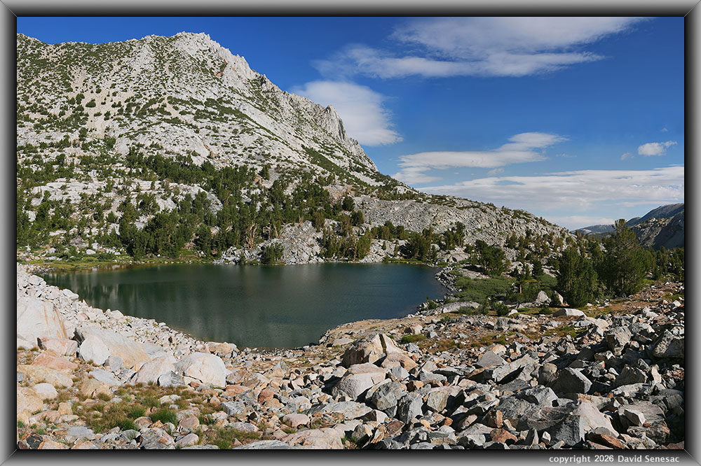
Storms with lightning, thunder, and small hail began before noon, keeping us mostly tent-bound. At 3:19pm, a southward view during a lull between thunderstorms. Note the calm lake conditions with a few circular wave rings of trout sucking down insects on the lake surface. The lake's outlet is mid-frame left in front of the rusty dome. The main trail is below trees at frame right. Such afternoon storm lulls offer about the only calm afternoon conditions, as afternoons are almost always breezy during fair, sunny weather as the atmosphere in valleys expands, pushing air up adjacent mountain canyons.
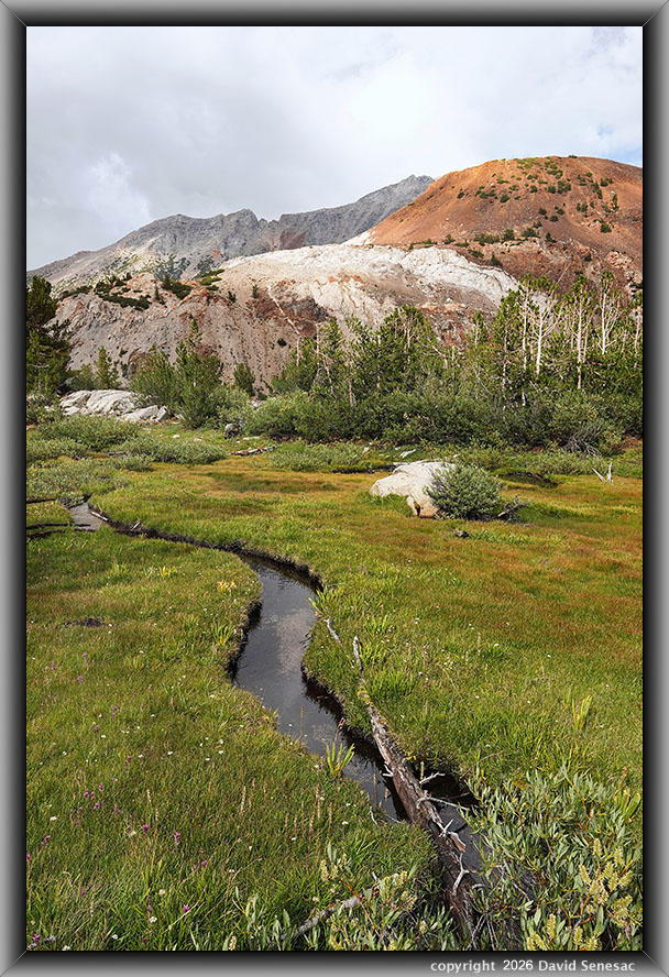
VS00289-94v 3800x5700 pixels 1 frame 6 shot focus stack blend a6700 17:40mm @17.0mm
enlarged vertical slice view
One of the most important subjects near camp that I wanted to capture was this avalanche meadow stream landscape with rusty-hued 11,682-foot Chocolate Peak. Lemmon's paintbrush and white-hued yarrow, Achillea millefolium, dotted the meadow. Unfortunately, my better captures of the scene had the previously noted lens infinity softness.
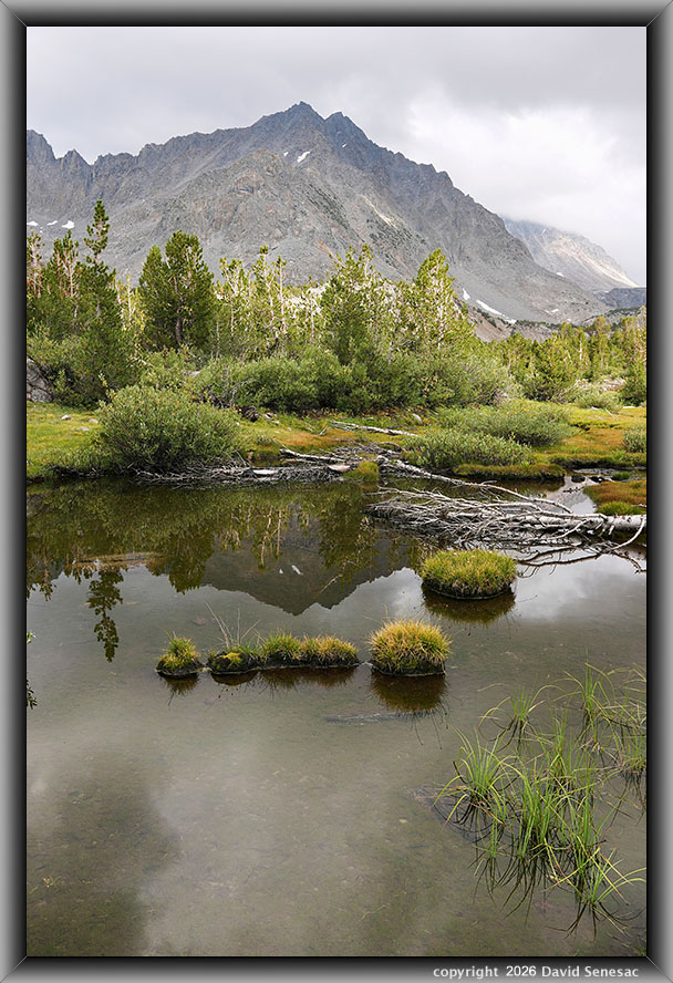
VS00331-35v 4100x6150 pixels 1 frame 6 shot focus stack blend a6700 17:40mm @19.8mm
enlarged vertical slice view
Another nearby subject I hoped to capture was a southeastward reflection from this small stream pool with turf hummocks. After another bout of storm, then a lull, I again tried to work these subjects and at 4:56pm managed this modest dead still reflection just before Hurd Peak shadows ended those attempts. Broken whitebark pine branches litter such meadows after being torn from slopes by winter snow avalanches off of steep Hurd Peak slopes. 13297-foot Picture Puzzle Peak is in the background. It would be a much better subject on a calm, sunny mid-morning. Note the still-melting, lingering summer snow patches. Soon after this, more storms kept us bottled up in our tents as we again retired early for night #3 with the sounds of rain.
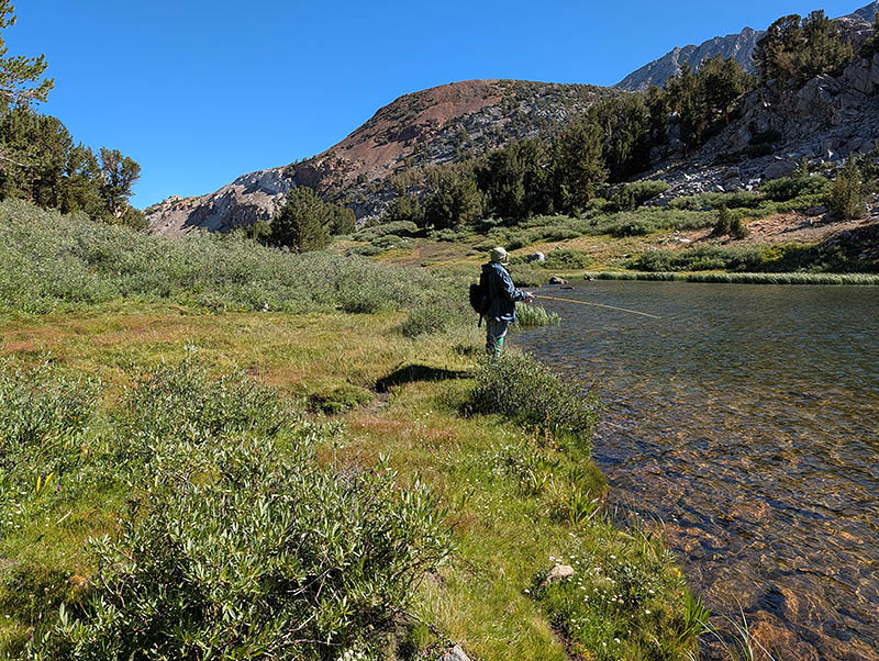
On Friday, August 14, 2026, we got up at sunrise. It was still too windy to work on any local subjects of interest, so I immediately decided to pack up and move to a campsite near the stream below Margaret Lake. Overnight, in the wee hours, the monsoon flow had ended, followed by dry, clear, windy air. My pre-trip plan had been to move to Ruwau Lake, but the storms had prevented me from working on more important subjects in our current area. So instead, would remove that camp spot idea and either spend two nights near Margaret or one there and a last night maybe near Bull Lake. We were packed up and on our way quickly; it took little time to reach this next semi-base camp spot. After arriving, I tried to do some photography work at Margaret Lake, but it was still much too breezy, so instead, with J, I hiked down to Spearhead Lake per image above, where he began fishing.
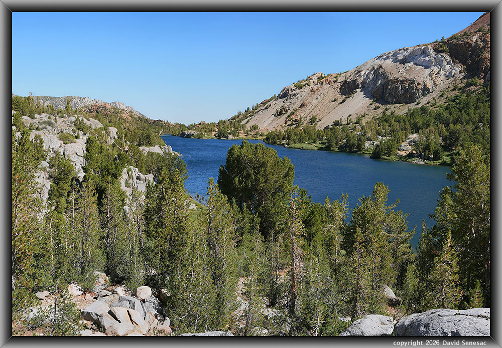
VS00341-00359-3x1v 8400x5700 pixels 3 column 1 row 3 frame 17 shot focus stack blend a6700 17:40mm @32.8mm
enlarged vertical slice view
I wandered down the ridge above the Spearpoint Lake stream to an overlook of Long Lake, where at 10:08am, I worked the above modest image southward. Below this position are well-used camp spots less than 100 feet from the lake.
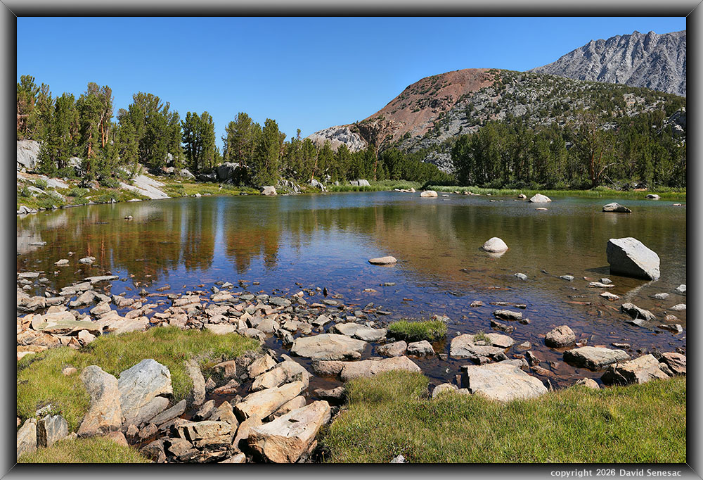
VS00381-00400-3x1v 8400x5600 pixels 3 column 1 row 3 frame 20 shot focus stack blend a6700 17:40mm @23.9mm
enlarged vertical slice view
From there, I climbed back up to the no-name shallow stream pond at 10835 feet, where, at 10:33am I worked during a minor wind lull; the above image from its inlet with Chocolate Peak framed mid-right. Notice at frame left how one can see the rusting granite pond bottom rocks where the green pines reflect while adjacent sky-blue areas mask the bottom rock colors.
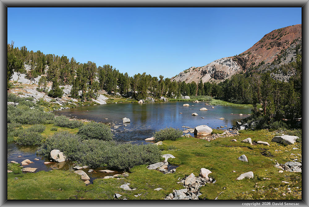
VS00411-00419-3x1v 8400x5600 pixels 3 column 1 row 3 frame 3 shot a6700 17:40mm @30.2mm
enlarged vertical slice view
Next, I climbed up on a small dome for this image at 10:56am, of the same pond.
VS00421-00430-2x1v a6700x6100 pixels 2 column 1 row 2 frame 10 shot focus stack stitch blend a6700 17:40mm @21.4mm
enlarged vertical slice view
And at 11:08am, I worked on a final image above, near the pond within its inlet stream with Chocolate Peak, the Inconsolable Range, and 13525-foot Cloudripper (peak) in the background. The rocks underwater are dark due to organic growth like algae, with areas of sand in areas of stronger flow where algae can't establish.
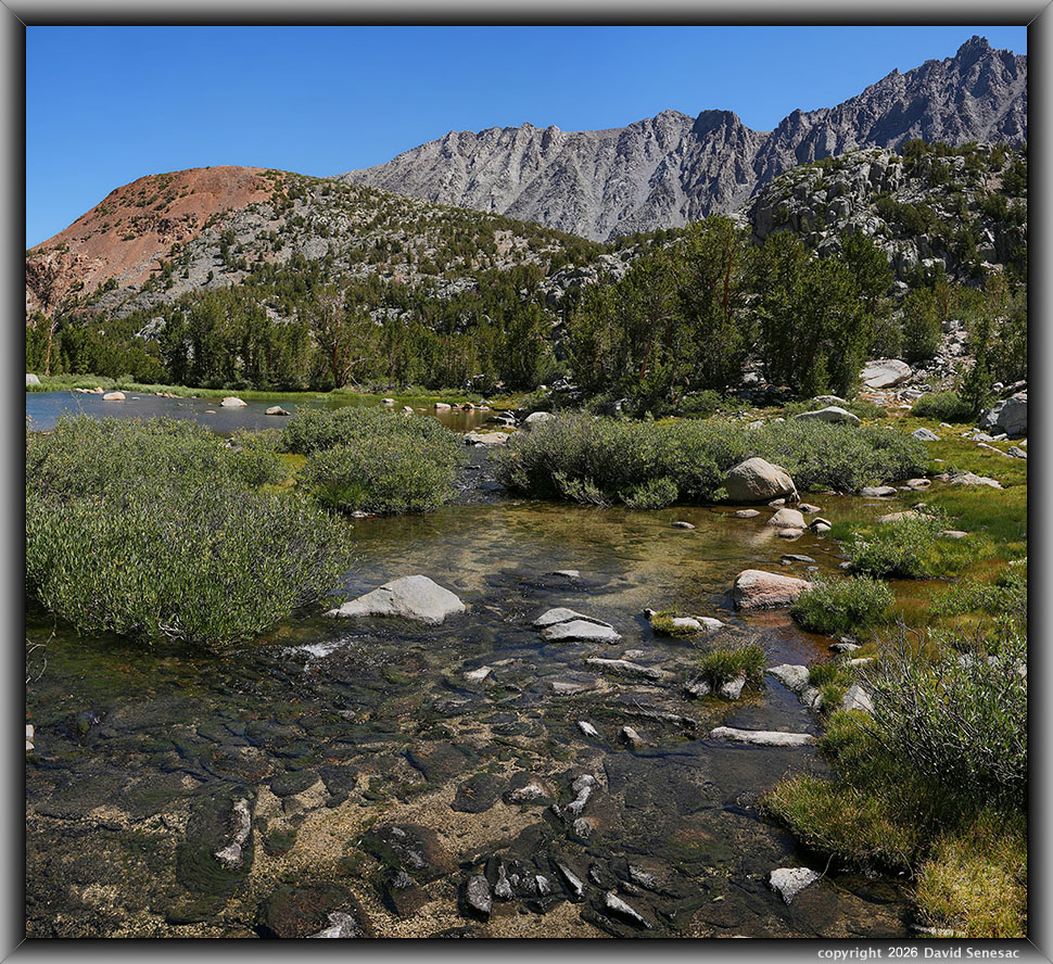
I hiked up to the Margaret Lake stream area near our camp and stood in the center of the shallow stream at 11:25am, where I worked the image VS00431-00450-3x1v at page top. Chocolate Peak is at frame left, then frame right, the Inconsolable Range with Cloudripper. The wind continued to blow stronger, which had me ending any further work, so I returned to camp where J had already returned, and began cooking lunch during the harsh midday sun. We enjoyed eating some of J's pan full of trout, which I complemented with rice. We then enjoyed a couple hours napping during the harsh midday sun.
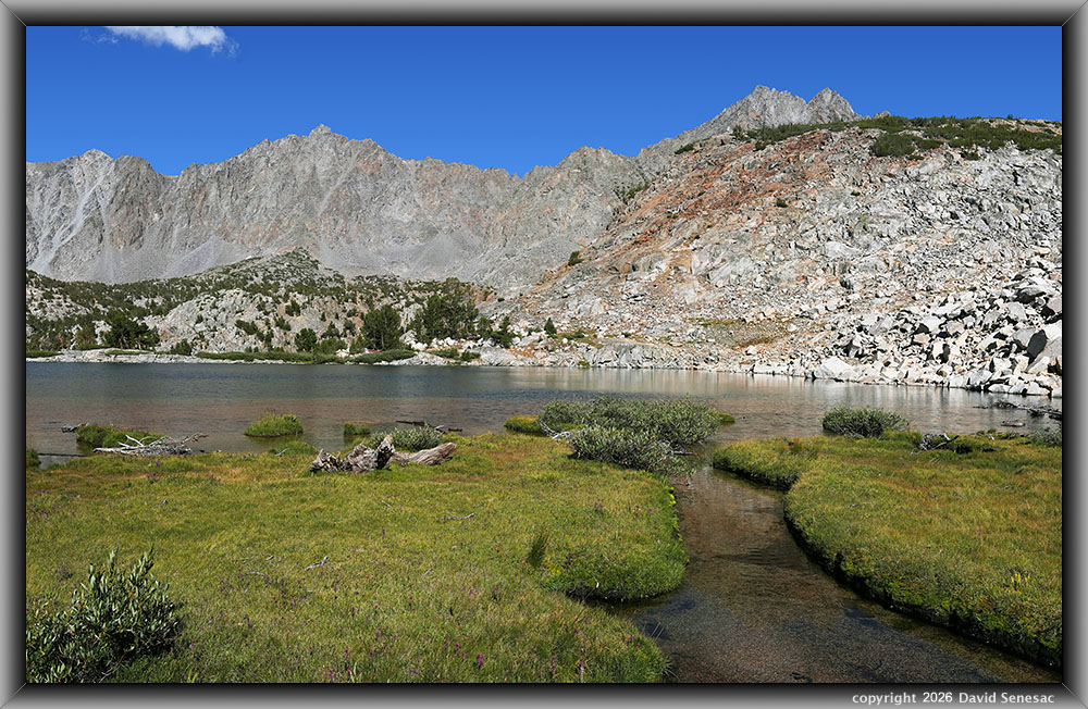
VS00458-00482-3x1v 9300x5900 pixels 3 column 1 row 3 frame 20 shot focus stack stitch blend a6700 17:40mm @25.6mm
enlarged vertical slice view
Later in the afternoon, I decided to explore the back side of Margaret Lake. Above is an eastward view at 4:23pm from the back side of Margaret Lake at its inlet stream towards the Inconsolable Range, Cloudripper, and Picture Puzzle Peak. In the turf are Lemmon's paintbrush and little elephant's head, Pedicularis attollens, flowers. A meadow with pieces of whitebark pine debris left from winter snow avalanches. Such meadow turf is a complex mix of plant species and very soft to walk on.
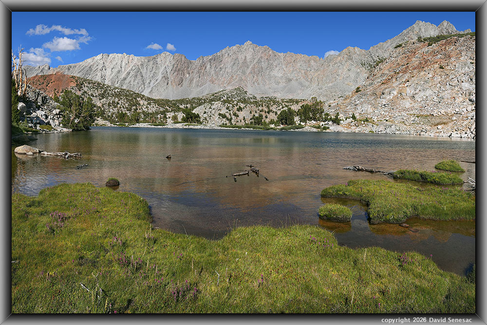
VS00496-00511-3x1v 6000x3900 pixels 3 column 1 row 3 frame 16 shot focus stack stitch blend a6700 17:40mm @21.1mm
enlarged vertical slice view
And a second northeast view image at 4:58pm from the Margaret Lake inlet stream meadow with the Inconsolable Range and Chocolate Peak in the distance under a very saturated blue sky. J is along the shore at frame left, having just taken a dip in the lake.
VS00512-00522-2x1v 6500x6000 pixels 2 column 1 row 2 frame 11 shot focus stack stitch blend a6700 17:40mm @21.1mm
enlarged vertical slice view
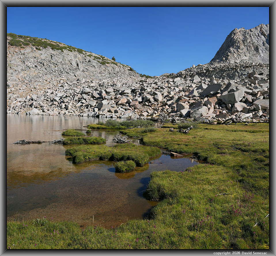
This third Margaret Lake meadow image is southeastward towards the rock glacier. Thursday, J had hiked up to the saddle at frame center to view Ledge Lake on the upper basin bench. Besides the paintbrush and elephant's head are yellow-hued common monkeyflower, Erythranthe guttata, with its genus name changed from Mimulus after recent DNA research.
This backpacking trip continues on Page 12 with additional images from this Friday afternoon of August 14.
NEXT: Page 12 SF Bishop Creek Backpack 8/12 2of2
2026 Trip Chronicles: Contents















